


Why to visit Robertson Cliffs
Robertson Cliffs is located in the Algoma Region of Ontario, north of Sault Ste. Marie. Ila's Trail was named after Ila Aho, an ardent hiker who travelled and constructed the trail.
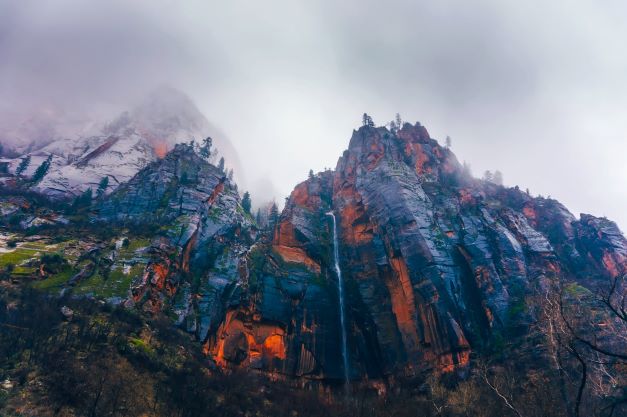
The track is 5 kilometres long, however you do not have to complete the entire loop. The uphill ascent to the cliffs, which are part of the Algoma Highlands Conservancy, can be done immediately. You'll stroll through Algoma's gorgeous Boreal Forest, stare out from cliffs overlooking the valley, and come upon a waterfall if you complete the entire loop.
Things to keep in mind while going for hiking :
• Because the terrain might be rocky and slippery at times, wear sturdy and supportive footwear.
• Light-colored pants will shield your legs from plants and trees.
It's a good idea to dress in layers so you can stay cold or warm as needed.
• Bug spray, as well as sunscreen and a hat, should all be carried with you.
• To stay hydrated, you'll need a water bottle.
• It's fun to eat a little lunch or snack at the top of the cliffs while taking in the view and resting, but remember that what you bring into the route, you take out of the trail, so don't leave any trash behind.
How to reach?
Drive 28 kilometres north on Highway 17 to reach Robertson Cliffs. Turn right onto Old Highway 17 after crossing the Goulais River Bridge, then the first right onto Robertson Lake Road.